


The Hong Kong Observatory said it will consider issuing the Strong Wind Signal No 3 during the daytime on Saturday, with Tropical Cyclone Wipha set to strengthen in intensity gradually.
The Standby Signal No 1 will be issued in the small hours of Saturday as the storm is expected to come within 800 kilometres of the city then, the forecaster said.
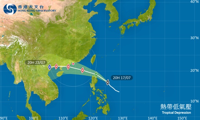
"Wipha will be rather close to the vicinity of the Pearl River Estuary on Sunday and expected to skirt around 50 kilometres from Hong Kong," it said.
The weather watchdog said the weather will remain hot on Saturday, with strong winds to hit later in the day.
It also urged the public to stay away from the shoreline, as thunderstorms and heavy rain will pour over the SAR on Sunday.
The observatory will also consider issuing higher typhoon signals if needed.
Former HKO assistant director Leung Wing-mo, meanwhile, has warned of the "significant threat" posed by Wipha to Hong Kong.
The meteorologist cited data from weather prediction models, saying the storm could directly hit the SAR.
"It avoided the land mass of Luzon. In that way, it will preserve its intensity as a severe tropical storm, and then it will start to intensify as soon as it gets into the South China Sea," he said.
"By the time it comes closest to Hong Kong, it is already a full-blown typhoon, of typhoon intensity up to a maximum of 140 kilometres per hour. Judging from every aspect of this tropical cyclone, it's going to be a significant threat to Hong Kong."
_____________________________
Last updated: 2025-07-18 HKT 21:26
T3 signal looms for daytime on Saturday
2025-07-18 HKT 15:58
Share this story


