


The Observatory issued the Standby Signal No 1 at 9.40pm on Friday, as it forecast a tropical depression to skirt some 500 kilometres south of Hong Kong from Saturday night to Sunday morning.
The Observatory said the no 1 signal will remain in effect until at least noon on Saturday.
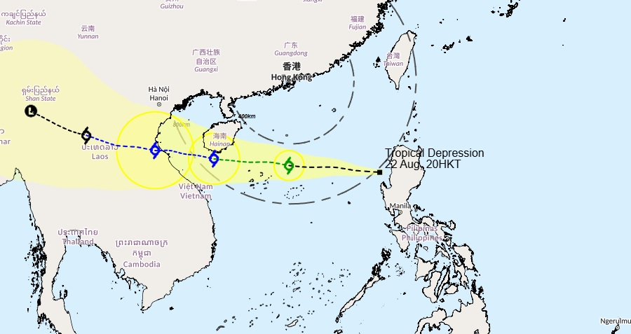
According to its forecast track, the tropical depression is moving west across the central and northern parts of the South China Sea towards the southern part of Hainan Island and the seas to its south.
It's also expected to gradually strengthen in the next couple of days.
The Observatory said the tropical cyclone will bring squally showers and thunderstorms to the northern part of the South China Sea and the coast of Guangdong, and there will be swells over the region.
"Locally, it's expected to be mainly fine at first and very hot during the day on Saturday, and the maximum temperature in the urban areas could reach 33 degrees Celsius or more," Cindy Lam, a scientific officer, told RTHK.
"However, there will be a few showers and squally thunderstorms with swells at night, and it will be windier with occasional squally showers on Sunday."
Forecasters added that the members of the public are advised to stay away from the shoreline and not to engage in water sports.
T1 to be in force until at least noon on Saturday: HKO
2025-08-22 HKT 22:13
Share this story


