


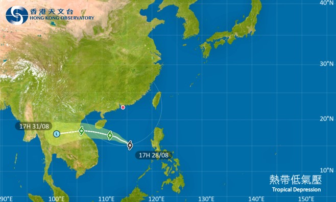
The Observatory issued the Standby Signal No 1 at 7:10pm on Thursday as a tropical depression moves across the South China Sea towards Hainan.
The tropical depression, which at 7pm was about 770 kilometres south of Hong Kong, is forecast to be closest to Hong Kong at around noon on Friday, skirting 600 kilometres or more from the SAR.
It's expected to intensify slightly as it heads in the general direction of the seas south of Hainan Island.
“Unless the tropical cyclone intensifies significantly or adopts a track closer to the coast of Guangdong, the chance of persistent strong winds generally over the territory is expected to be relatively low,” it said.
The Observatory added that the No 1 signal will remain in effect until at least 9am on Friday.
The weather forecaster said there will be swells on Friday, with isolated squally thunderstorms at first.
Standby Signal No 1 in effect
2025-08-28 HKT 19:29
Share this story


