


The Observatory issued the Strong Wind Signal No. 3 at 2.40am.
The forecaster said the signal would remain in force for most of the day.
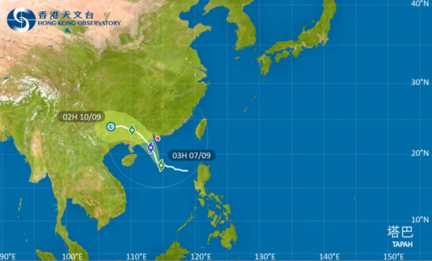
Tropical Storm Tapah was forecast to move west or west-northwest at about 14 kilometres per hour, edging closer to the western coast of Guangdong.
According to the present forecast, Tapah will intensify gradually and skirt around 200 kilometres to the southwest of the SAR on Monday morning.
However, the Observatory said Tapah's circulation will be relatively small.
The forecaster said it would decide whether to issue higher warning signals on Sunday night, depending on the rate of intensification of the storm and its closest distance to Hong Kong.
T3 signal to be in force for most of Sunday
2025-09-07 HKT 05:53
Share this story


