


The Observatory issued the No 8 Southeast Gale or Storm signal at 9.20pm on Sunday as Tapah intensified into a severe tropical storm.
Forecasters said the No 8 signal will remain in force until at least 11am on Monday, and that the chance of higher signals is "relatively low" unless the storm adopts a track closer to the Pearl River Estuary or strengthens significantly.
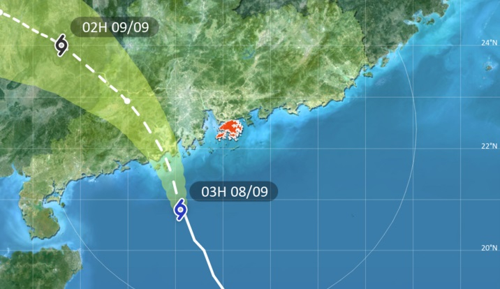
At 4am, Tapah was about 190 kilometres southwest of the SAR and is forecast to move northwest or north-northwest at about 18 kilometres an hour, edging closer to the coast of western Guangdong.
The observatory said the storm is expected to make landfall over the next few hours.
Tapah's rainbands are bringing heavy squally showers to the Pearl River Estuary. Gale force winds are affecting offshore areas, and winds on high ground are reaching storm force, while seas are very rough with swells.
Classes of all day schools on Monday – including secondary schools, primary schools, special schools, kindergartens and kindergarten-cum-child care centres – have been suspended.
And with the No 8 signal in force, the Hong Kong-Macau Ferry Terminal in Sheung Wan and the China Ferry Terminal in Tsim Sha Tsui have been closed temporarily.
Air traffic is also being disrupted with several airlines announcing the cancellation of flights. Passengers are being urged to check with the airlines for the latest flight information.
_____________________________
Last updated: 2025-09-08 HKT 03:58
T8 in effect but higher signals not likely, says HKO
2025-09-07 HKT 22:00
Share this story


