


The observatory says it plans to issue the Standby Signal No 1 on Wednesday night, as a storm approaches the South China Sea.
At the same time, it also warned that a stronger storm could reach the SAR in the middle of next week, with gale force winds possible next Wednesday.
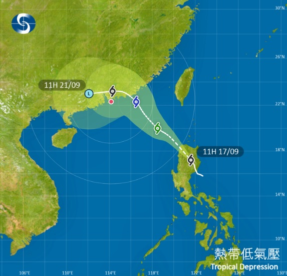
Forecasters said the first storm would intensify gradually as it moves towards the coast of eastern Guangdong.
They said it has a relatively small circulation, and there are uncertainties regarding its intensity and where it will make landfall.
"Depending on the intensity of the tropical cyclone, the distance of its strong winds from Hong Kong and the change in local wind conditions, the observatory will assess the need to issue higher tropical cyclone warning signals later on Thursday to Friday," the agency said.
It said the weather will become unsettled on Friday, and it is expected to be windy with occasional heavy squally showers and thunderstorms over the weekend.
Meanwhile, the territory is likely to be affected by a stronger storm that is expected to form to the east of the Philippines by Thursday, the observatory said.
"Under the influence of the extensive circulation of the tropical cyclone, the weather will deteriorate significantly over the region midweek next week," it said.
"Winds will strengthen again with heavy squally showers and thunderstorms."
The observatory added that there might also be flooding in coastal areas.
T1 tonight as storms queue up to batter HK
2025-09-17 HKT 14:53
Share this story


