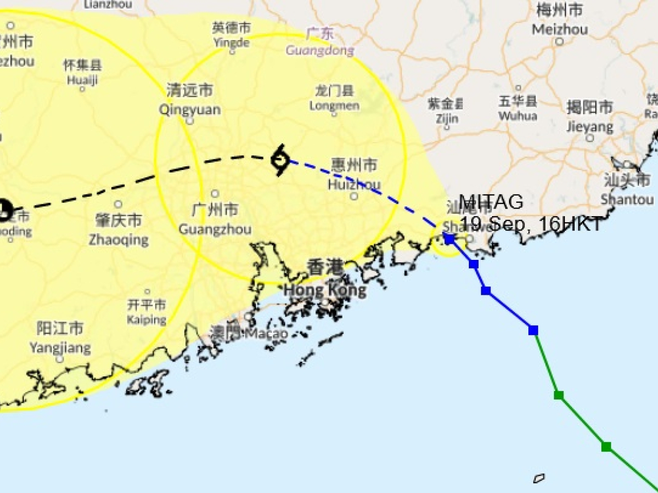
The Hong Kong Observatory said on Friday it’s unlikely to issue a T8 signal as Tropical Storm Mitag has weakened after making landfall near Shanwei earlier in the afternoon.
However, the storm – centred around 120 kilometres northeast of the territory as of 5pm – is expected to get slightly closer on Friday night and Saturday morning, as it moves northwest at about 10 kilometres per hour towards the vicinity of the Pearl River Estuary.
Forecasters expect Mitag to pass around 100 kilometres to the north of Hong Kong, and the T3 signal, which was issued at 9.20am on Friday morning, will remain in force until 9am on Saturday at the earliest.
“Unless Mitag adopts a track closer to our territory and maintains a higher intensity, the chance of issuing higher tropical cyclone warning signals is relatively low,” the observatory said.
However, the storm is still expected to bring strong winds and squally showers to the SAR.
Classes for all AM and whole-day kindergartens, schools for children with physical disability and schools for children with intellectual disability will be suspended on Saturday. The schooling arrangement for classes of PM kindergartens will be announced later.


