


The observatory said it will issue the Strong Wind Signal No. 3 at 9.40pm on Monday before possibly raising that to a No. 8 warning between 1pm and 4pm a day later.
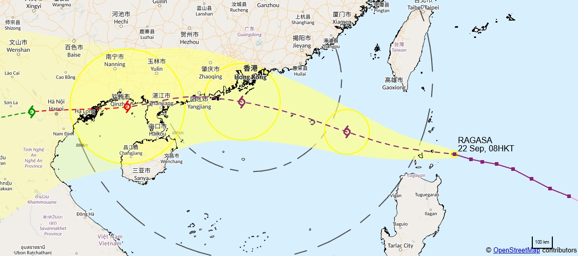
The weather agency laid out the potential timeline after issuing the Standby Signal No. 1 at 12.20pm as Super Typhoon Ragasa was set to enter within 800 kilometres of the city.
"The local weather is expected to deteriorate rapidly later [on Tuesday]," forecasters said.
"The observatory will consider issuing the Gale or Storm Signal No. 8 between 1pm and 4pm [on Tuesday].
"The weather will be persistently adverse on Wednesday. Gale to storm force winds will prevail locally, and winds may reach hurricane force offshore and on high ground. There will be frequent heavy squally showers and thunderstorms."
The observatory also warned of rising water levels in parts of the territory.
"Under the influence of significant storm surge, there will be a rise in water levels of about two metres over coastal areas of Hong Kong," it said.
"The maximum water level can generally reach around 3.5 to four metres above chart datum, and the water level at Tolo Harbour may even reach four to five metres above chart datum," the observatory added, citing a reference level for measuring tidal heights and charted depths in Hong Kong waters.
T3 at 9.40pm on Monday, T8 possible Tuesday afternoon
2025-09-22 HKT 12:55
Share this story


