


The observatory says it will consider upgrading the T8 signal to T9 between 1am and 3am on Wednesday as Super Typhoon Ragasa gets closer to Hong Kong.
The number eight signal was issued at 2.20pm on Tuesday.
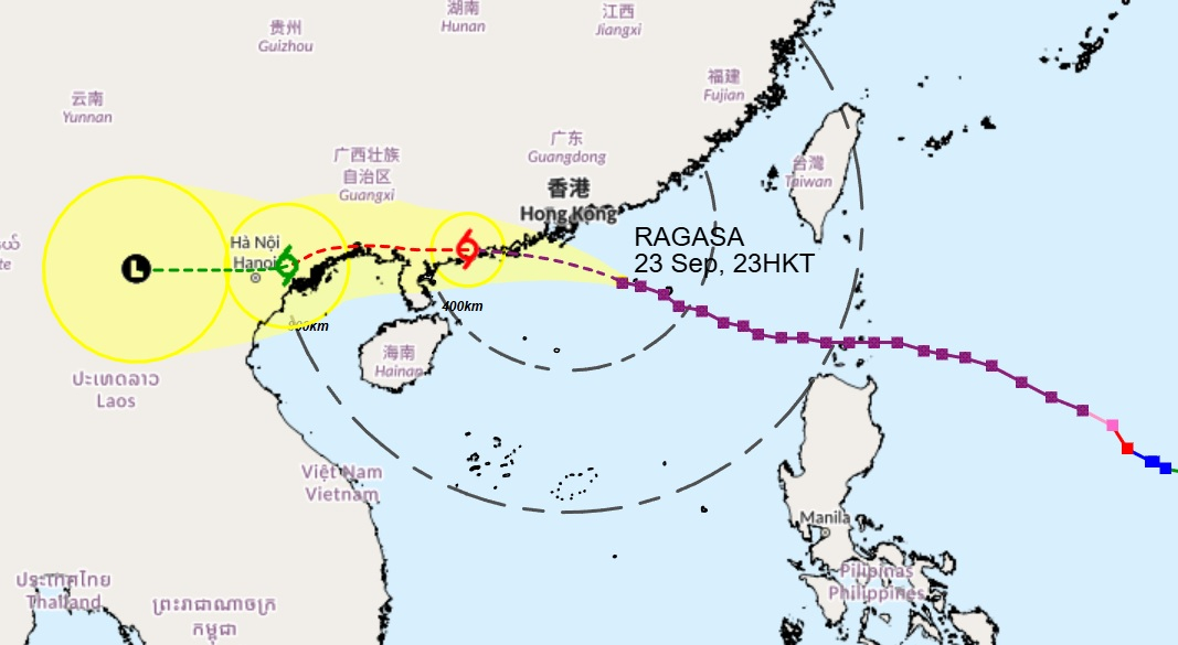
Forecasters said hurricane-force winds are expected to “edge close to Hong Kong gradually”, with winds continuing to strengthen further overnight, before the storm passes around 100 kilometres to the south of the territory on Wednesday morning.
Gusts of wind of up to 116 kilometres per hour have been recorded at Tate’s Cairn.
“The weather is expected to deteriorate rapidly overnight,” the observatory warned in a statement.
“The weather will be persistently adverse tomorrow with frequent heavy squally heavy showers and thunderstorms.
"Seas will be phenomenal with swells and overtopping waves over the shoreline, which will be particularly significant along the eastern and southern coasts."
_____________________________
Last updated: 2025-09-23 HKT 23:01
Observatory to consider T9 signal between 1-3am
2025-09-23 HKT 17:11
Share this story


