


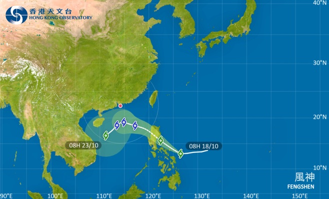
The observatory says it will consider taking the rare step of skipping the Standby Signal No 1 and move directly to issuing the Strong Wind Signal No 3 on Monday when Tropical Storm Fengshen moves closer to Hong Kong.
It expects Fengshen to be closest to the SAR on Tuesday, when it will assess the need for issuing a higher warning signal.
Local winds will strengthen gradually on Sunday as an intense northeast monsoon is expected to reach Guangdong.
Scientific Officer Tse Kwan-shu explained why the observatory may abandon the usual step of first issuing a number one signal for the approaching storm.
"The local wind strength might already reach the strong wind levels after the intense northeast monsoon dominates the coast of Guangdong. But at that time, the tropical cyclone might not have entered 800 kilometres from Hong Kong," Tse told RTHK on Saturday.
"When the tropical cyclone gradually gets closer to the coast of Guangdong, the local winds might still remain at strong wind levels. So in that case, the local winds will not have a trend of dropping before the tropical cyclone actually edges closer."
_____________________________
Last updated: 2025-10-18 HKT 19:34
Monday may see rare T3 start to alerts for new storm
2025-10-18 HKT 12:50
Share this story


