


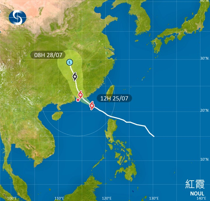
The Observatory says it will issue the Strong Wind Signal No 3 at 1.20 pm, as tropical cyclone Noul edges closer to the coast of eastern Guangdong while intensifying slightly.
It said its outer rainbands are affecting coastal areas, with local winds expected to strengthen gradually, bringing more squally showers.
The Observatory said according to the present forecast track, Noul is expected to make landfall between Huizhou and Shanwei on Sunday morning. It said depending on the distance between the landfall location and Hong Kong, the size of its gale winds, and local wind conditions, the Observatory would assess the need for any higher tropical cyclone warning signals later tonight.
_____________________________
Last updated: 2026-07-25 HKT 12.16
Edited by Robert Kemp
Observatory to issue T3 at 1.20 pm
2026-07-25 HKT 10:14
Share this story


