


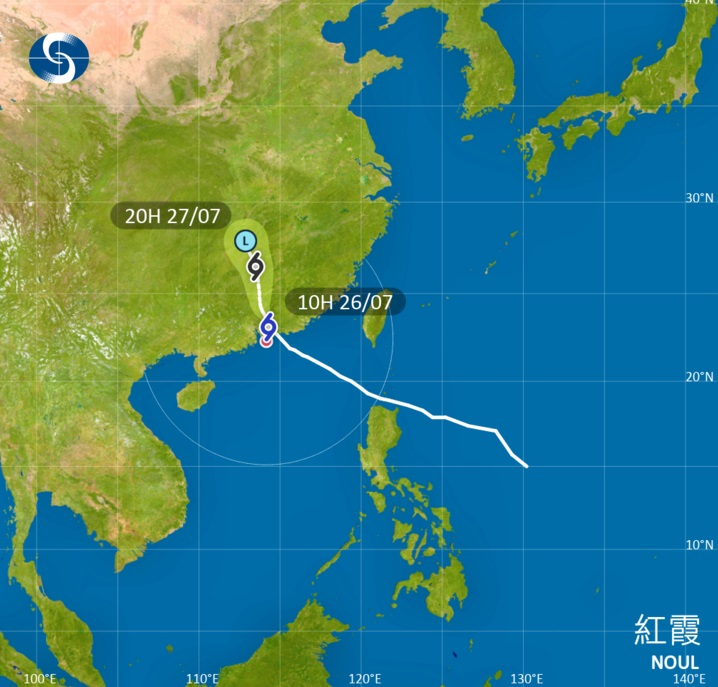
The Observatory will issue the Strong Wind Signal No. 3 at 12.40pm, as Typhoon Noul continues its steady march into inland Guangdong.
While the storm is progressively weakening and edging away from the territory, the forecaster warns that gale-force southwesterly winds will continue to intermittently impact offshore areas and high ground.
According to Acting Senior Scientific Officer Ng Yin-lam, local winds are expected to ease as Noul moves further away.
However, she cautioned that the territory is not yet in the clear.
"Under the influence of the intense outer rainbands associated with Noul, there will still be frequent heavy squally showers and thunderstorms over the territory on Sunday," she said.
"Seas will be high with swells," Ng added, urging members of the public to remain vigilant, stay away from the shoreline and refrain from engaging in water sports.
Edited by Tony Sabine
T3 to be issued at 12.40pm
2026-07-26 HKT 10:48
Share this story


